MAPS!!!! ALOT OF MAPS!!!!
Thursday, September 30, 2010
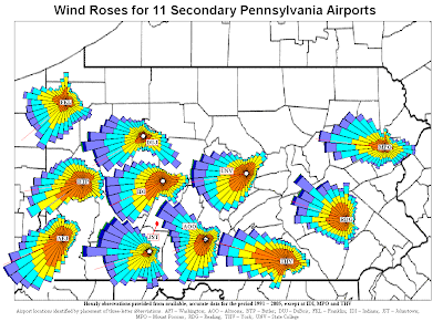
Windrose map
source link
This map shows windroses for 11 secondary Pennsylvania airports. This map was constructed by Penn State University.
Cartograms
source link
This map shows Agricultural Biodiversity throughout the country.
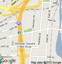
LINDAR map
source link
This LINDAR map shows the location of Ferraro's foods in the state of Connecticut. This type map is tipically see on google maps.
PLSS MAP
Source link
This map shows the state of Minnesota broken up into quarter sections and quarter section quadrants. It also show county codes, number of government lots, government lot numbers, and acres
Newer Posts
Older Posts
Home
Subscribe to:
Comments (Atom)